To celebrate the year 2000
The map and index from the Millennium Committee’s “Memento”. Sponsored by the two Parish Councils a copy of the memento was presented to every young person in the villages under the age of 18.

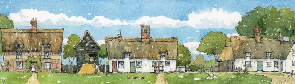
The Rich Heritage of Histon and Impington
- Gun’s Lane: An ancient route to Ely following higher ground. William the Conqueror and army passed this way chasing Hereward the Wake and rebels into the fens.
- The site of St Etheldreda’s Church: Much of it was demolished by 1600 by the then Lord of the Manor, Sir Francis Hinde, who is reputed to have either sold or reused its stone, timber and lead in the building of a new wing to Madingley Hall.
- Penny Lane looking north from the east entrance to Abbey Farm. It served as an old road to both St. Elthelreda’s and St. Andrew’s Churches. The remaining section of the old road now links with Croft Close and the lane leading from St. Andrew’s Church, Histon.
- Site of Roman Homestead: As revealed by pottery and old ditch network.
- Site of Iron Age Settlement: As revealed by aerial photographs and worked flints.
- Site of surviving Saxon ridge and furrow: Heavy clay soils don’t drain easily. The Saxons built ridges 15m across so that water could drain off into the resulting furrows.
- Moat: The water defence may have been the site of an early Histon Manor (or a medieval garden status symbol!).
- Mill: By surviving Swan Pond a sketch survives showing this mill derelict in 1785.
- Old site of Chivers Jam Factory, built in 1873. The Station Road front has been replaced by Vision Park and the Chamber of Commerce [now The Company of Biologists].
- Roman Homestead: As revealed by aerial photographs.
- Crosswell or Cresswell Spring: An old water source for The Brook.
- Saffron Close: Harvested only every three years the saffron crocus was grown here for its bright yellow stamens. Even today this spice costs more than its weight in gold!
- Elizabeth Woodcock Memorial commemorates Elizabeth Woodcock’s 8 day entombment in January 1799.
- Elizabeth Woodcock cottage survives in Station Road near to the war memorial and carries a commemorative plaque.
- New Road: New in the early 17th century. Built as a shortcut to Cambridge Road bypassing the muddy ford at Histon Green.
- Impington Moor: Just beyond the stream at the bottom of Impington Village College School field. During the Black Death it flooded and went out of cultivation for several hundred years. Seventeenth century plague victims were buried there.
- Bronze Age site straddling Mere Way as discovered by recent dig. The Mere Way (Impington/Milton boundary) is a Roman road into the fens.
- Roman Villa Farm superimposed on Iron Age site including pre-Christian burial mound. Discovered by recent dig situated near Milton, on Butt Lane.
- The Windmill: Tower Mill c1805 which appears to have replaced an earlier postmill. Ceased working c1929, probably on the death of John Chivers, the owner. The last miller was Mark Wilson.
- Histon Moor: Lowest point in the village. Moses Carter had his market garden there.
- Impington Hall: Now Percheron Close. Home of the Pepys family whose famous cousin Samuel used to visit from London.
- Medieval Impington Manor Farm and Church enclosure: Now Burgoyne’s Farm Close. Site of Burgoyne Tithe Barn: Possible 13th century Impington Manor of Peter de Chauvent who entertained Edward I c1298.
- Histon Green and Pump: Only a third remains of the Green that stretched back along the brook to School Hill. The traffic lights were the site of a muddy ford.
- Stone Corner Cottage Old Cottenham Road: oldest domestic building, 13th century aisled construction.
- The Old House: The oldest brick encased building in Histon which features a priest hole.
- 19th century Blacksmith’s forge.
- 19th century abattoir.
- Arbury Camp: Fortified Iceni (iron age) settlement downgraded by Roman times to a possible animal enclosure.
- Spring Close: Another source of water for the Brook.
- Barrow Hill: The rise from Cottenham (possible site of old burial mound).
- The home of `Mo’ Carter, the Histon giant.
- The Boot: 17th century Inn. Site of ‘Mo’ Carter’s ballast stone.
- St Andrew’s Church, Impington: Late 12th century. One of the smallest parish churches in Cambridgeshire which includes a 15th century fresco and Burgoyne Brass c1525.
- Impington Village College designed by Gropius and Fry, important architects of the Bauhaus movement, and opened in 1939.
- Rose and Crown c1590: Has been a public house for around 150 years. The remains of tiny medieval windows can still be seen.
- Baptist Church. Opened Easter Monday 1900.
- Railway line arrived August 1847: Closed to passengers October 1970 and freight in May 1992.
- Methodist Church, High Street, Histon. Built 1896 replacing an earlier building of 1822.
- St Andrew’s Church Histon: 13th century cruciform church with remains of Norman tower and fine arcading in the 14th century transepts.
- Salvation Army: Site of Salvation Army citadel built 1956 replacing an earlier corrugated iron hut.
- Unwins: Founded by a farming family who have lived in Impington for 200 years. They started their internationally renowned seed business in 1903.
Produced by Histon and Impington Millennium Committee in co-operation with Eleanor Whitehead and Alan Eade of the Village Society.
| Printed version: | Photos – Anton Heinrich, A. Starling, E. Whitehead |
| Design – Paul Watford | |
| Printers – Print-out, Histon | |
| Publication date: March 2000 |
